
software für den öpnvIntelligente IT-Lösungen für mehr Nachhaltigkeit
MENTZ ist die führende Adresse in Deutschland, wenn es um die Themen Verkehrsplanungs- und Verkehrsinformationssysteme geht.
Unsere IT-Lösungen rund um eTicketing, Apps, Echtzeitdaten, Fahr- und Dienstplanung treiben die Digitalisierung des ÖPNV an. Seit 50 Jahren entwickeln wir Software und übernehmen das Datenmanagement für Verkehrsverbünde und -unternehmen. Für mehr Nachhaltigkeit, für moderne Mobilität und einen starken ÖPNV.
IT-lösungen von mentz Fahrt aufnehmen für moderne Mobilität

Unsere elektronische Fahrplanauskunft (EFA) bringt alle Optionen moderner Mobilität zusammen: So können Fahrgäste ÖPNV, Car-Sharing, Bike-Sharing & Co. mit Echtzeitinfos nutzen und halten alle Möglichkeiten in der Hand: Planen, buchen, bezahlen.

Effiziente Planung auf Topniveau: DIVA ist unser Powertool für Ihre Angebots- und operative Planung. Mit dem DIVA System und der GENIOS Optimierung haben Sie Ihre Abläufe auf allen Ebenen fest im Griff. Mit DIVA designen Sie ganz flexibel unterschiedliche Szenarien für Umlauf-, Fahr- und Dienstplanung sowie für Fahrzeugmanagement. Unsere Optimierungslösung GENIOS sorgt für optimalen Ressourceneinsatz und maximale Wirtschaftlichkeit.

Bargeldlos, einfach und sicher – so soll modernes Ticketing im ÖPNV funktionieren. Dafür haben wir mit dem MENTZ Shop die One-Stop-Lösung entwickelt: Egal ob klassisches eTicketing oder In-Out-Lösung, mit dem MENTZ Shop bleiben Sie flexibel. Das schafft Vertrauen und macht den ÖPNV zum fairen Mobilitätspartner.

Das Optimum erreichen, die perfekte Balance zwischen Ressourcen- und Personaleinsatz, bei voller Flexibilität: GENIOS von MENTZ macht Ihren Betrieb fit für den Nahverkehr der Zukunft. Wir haben von der Natur gelernt: Unsere Integrierte Optimierung berechnet Umlauf- und Dienstpläne parallel und nutzt einen genetischen Algorithmus. Das ist modernste Verkehrsplanung basierend auf einem flexiblen Framework.

E-Mobility ist die Zukunft, gerade im öffentlichen Verkehr. Das bedeutet aber auch: neue komplexe Anforderungen an Ihre Umlaufplanung, zum Beispiel bezüglich Reichweite, Ladeinfrastruktur und Ladedauer von Elektrobussen. Mit DIVA von MENTZ erstellen Sie schon jetzt belastbare Planungen.

Gullivr ist unsere innovative All-In-One Mobilitäts-App
Gullivr ist ein Lizenzprodukt, das einfach an ihre Corporate Identity angepasst werden kann. Ziel unseres Gullivr-Entwicklungsteams war Mobilität ohne Schnickschnack. So setzen wir ihr Branding modern in Szene, für ein maßgeschneidertes Erlebnis ihrer App-Nutzerinnen und Nutzer.

Engagierter, nachhaltiger Wissenstransfer, abgestimmt auf die Themen der IT
Niemals stehenbleiben – dieses Credo treibt MENTZ seit 50 Jahren an. Wir entwickeln nicht nur Software und Services für den Verkehrssektor, sondern auch uns selbst kontinuierlich weiter. Dieses Know-how bringt Sie voran, z.B. in Form unserer Beratungsleistungen und Trainings.
Arbeiten bei Mentz

Mit rund 260 Mitarbeitern ist MENTZ ein mittelständisches Unternehmen, das mit Kunden auf allen fünf Kontinenten global tätig ist. Unsere Mitarbeiter vertreten über 20 Nationen und kommen aus unterschiedlichen technischen und nicht-technischen Ausbildungen und Studiengängen.
News Was gibt es Neues aus dem Hause MENTZ?
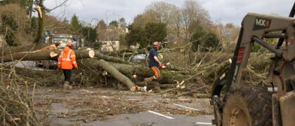
Fahrgäste werden im Störungsfall zuverlässig und zeitnah über Verspätungen, Baustellen oder Ausfälle informiert.

Um verlässliche und intuitive Reiseinformationen zur Verfügung zu stellen, brauchen Städte, Mobilitätsanbieter oder öffentliche Institutionen gemeinsame Standards und Werkzeuge.
Mit dem Wechsel zum Standard Layout 3+ (SL3+) von MENTZ hat die Bayerische Eisenbahngesellschaft (BEG) Fahrtauskünfte auf ihrer Webseite weiter verbessert.

Der EMS-Redaktionraum vereinfacht die Zusammenarbeit bei der Kommunikation von Störungsmeldungen

Insgesamt acht Mobilitätsapps hat sich die Redaktion der aktuellen CONNECT Ausgabe vorgenommen. Platz 1 erreichte die App unseres Kunden MVV, des Münchner Verkehrs- und Tarifverbunds. Dazu gratulieren wir herzlich!

Für das Deutschland Ticket Studium nutzt die Würzburger Straßenbahn AG das sichere Shibboleth Verfahren.
Cases Nachhaltige Partnerschaft
Unser Ziel: Zufriedene Kunden. Als Dienstleister für den ÖPNV sorgen wir dafür, dass Verkehrsunternehmen und -verbünde auf der ganzen Welt erfolgreich sind. Dank digitaler Technik von MENTZ. Dafür stehen unsere
Cases Ausgewählte Lösungen
Konkret ist besser als abstrakt, gerade wenn es um komplexe Lösungen geht. Hier eine kleine Auswahl unserer Referenzen. Auf Wunsch berichten wir ausführlich über diese und weitere Projekte oder vermitteln passende Ansprechpartner auf Kundenseite. Nehmen Sie jetzt Kontakt mit uns auf!
Info Jetzt einlesen in die Mobilität von morgen
Beiträge zu aktuellen MENTZ Projekten und relevanten ÖPNV-Themen, dazu Updates rund um unsere User Groups und Arbeitskreise. Bestellen Sie jetzt Ihr Exemplar des MENTZ Magazins! Das Abo ist für Sie kostenfrei.
